AeroApps Services
Spraying and Spreading
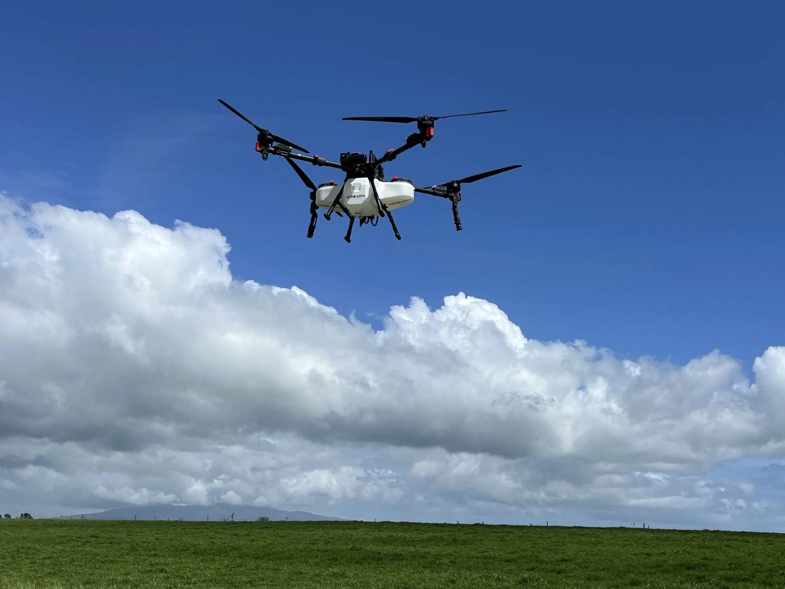
Agricultural drones deliver accurate and even spray and spread applications with the ability to control distance, delivery volume and consistency of product to the target. This results in a more effective use of chemicals, reduced water consumption and less over-spray.
Ag drones can operate in places traditional machinery can not due to challenging terrain, access and risk to people involved in ground or manned aerial operations. Drones provide a viable means of spray and spreading application, particularly in wet ground conditions. Ground compaction and resulting crop damage is eliminated making drone application an obvious choice when the ground is soft or wet. No more ruts, tracks and squashed crops in your paddocks.
This technology can be used to apply herbicides, pesticides, fertilizer, growth enhancers, amendments, liquid, granules and seed. It can be used in broad acre or targeted applications.
We combine our mapping drone technology into our spraying and spreading operations by pre-mapping our target operations.
We prepare 3D flight routes ahead of attending site to apply products. This allows us to undertake works faster in small weather windows and at night. This also provides the highest level of safety by identifying obstacles, boundaries, no-fly and no-spray areas for your confirmation ahead of application.
Find out more about 2D mapping and 3D modelling in our mapping section.
Roof and Solar Panel Treatments
An ideal way to apply moss and mould treatments to roofs and other surfaces. The use of drones removes the risk to people of falls from height, chemical exposure and eliminates any possibility of damage caused by walking in the wrong places along with the cost of scaffold or edge protection. We have specific products available for commercial roofs, glasshouses, poly or grow tunnels and solar panels to name a few.
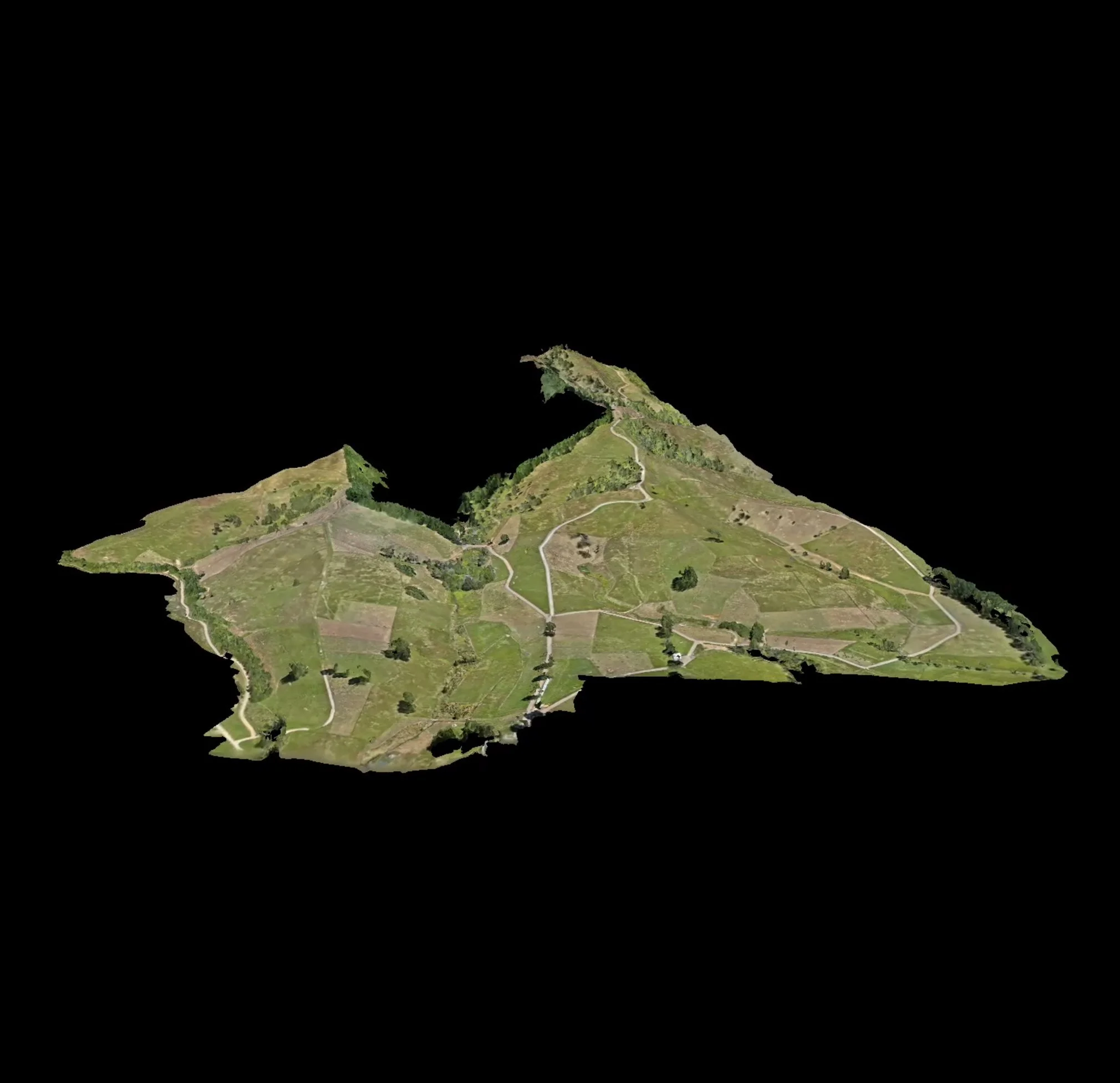
Mapping
Mapping isn't just a picture from above. We use mapping drones to create the most up to date 2D map or 3D model possible to provide the highest level of accuracy and detail for a range of applications including:
Stock pile volume measurement
Building, land and property Inspection
Construction progress and reporting
Environmental management
We can provide raw data and imaging direct from our drones and physical 2D or digital maps and 3D models, timelapse, updates and changes.
For agricultural applications we use mapping drones to pre-plan flight routes and prescription rates to specifically target crops for any application. 3D flight routes are created ahead of time to identify obstacles, no-spray and no-fly zones for your approval ahead of application.
Overwatch
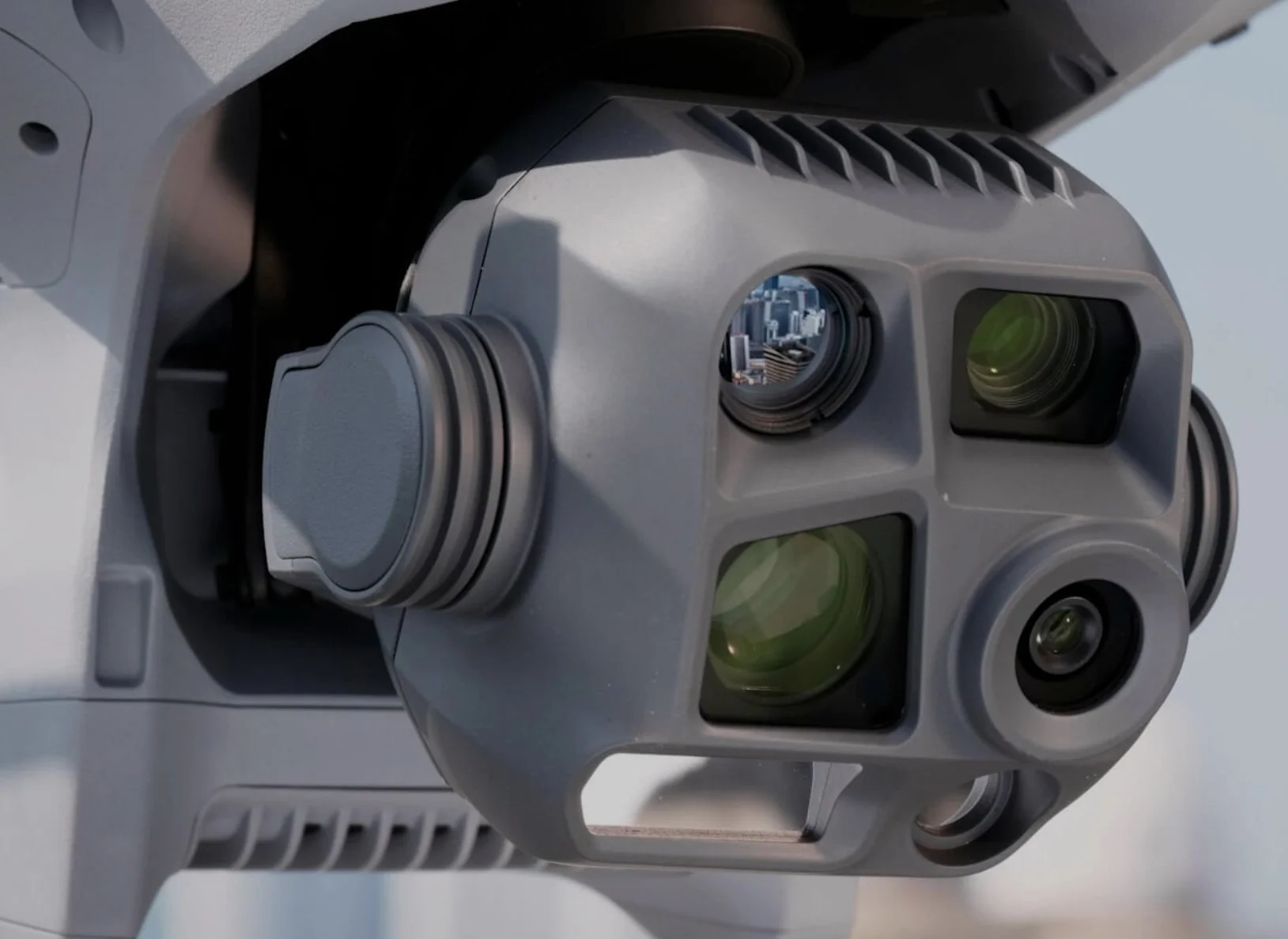
We use the latest in enterprise drones capable of over 100x zoom for mapping and overwatch. Talk to us about what you want to find, monitor or observe.
Thermal capabilities allow easy identification and location of people, vehicles, stock, conduct pest surveys/locations, hot spots and more.
We can count people and vehicles to monitor traffic flow, congestion, peak and slow traffic periods.
Our drone becomes a virtual fixed or mobile CCTV camera with real time streaming and recording capabilities. Flights and observation operations can be conducted manually or automated to conduct an identical operation repeatedly.
All monitoring and recording are required to meet New Zealand privacy and security rules and regulations.
How it works
1.Meet
We come to you and discuss your requirements onsite.
2. Map
We map the application area while onsite.
3. Process
We take the mapping information and process it into 2D maps and 3D models.
4. Plan
We plot our flight routes in 3D, mark out no spray zones, obstacles and no fly zones and upload it to our application Drones.
5. Apply
We return to site to apply the desired product in the appropriate weather window with our preplanned flight routes eliminating risk of collision overspray or any form of contamination.